
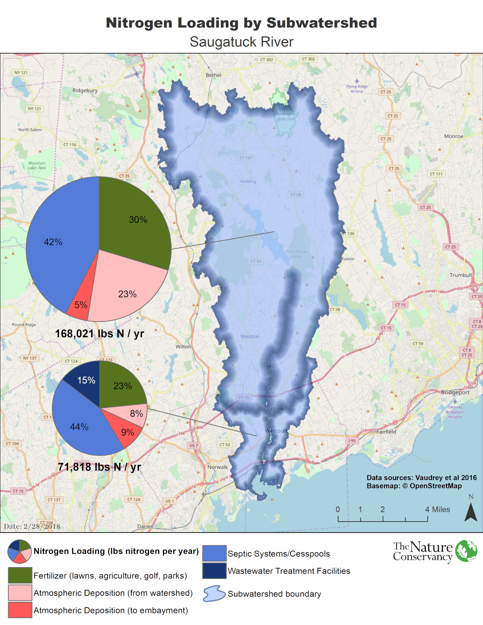
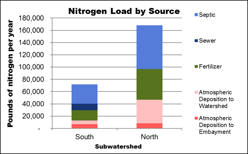
The Long Island Sound Nitrogen Loading Model
This model estimates the amount of nitrogen, created by human activity, that enters coastal embayments like the Saugatuck River. The model was developed by Dr. Jamie Vaudrey at the University of Connecticut in 2016, and uses:
- Population data, existing sewer areas and parcel maps to calculate estimated nitrogen loads from residential septic systems.
- Land cover types and predicted fertilizer application rates to estimate nitrogen from lawns, agriculture, parks and golf courses.
- Nitrogen from atmospheric deposition that falls on the watershed in the form of precipitation or dust, and adds to the total load.
- Nitrogen loads from wastewater treatment plants are added to the calculated nitrogen loads where applicable.
- The watershed depicted in this map differs from the US Geological Survey subwatershed delineations. It was developed using elevation data to simulate potential groundwater drainage.
For more information about the Long Island Sound Nitrogen Loading Model, visit the Vaudrey Lab Website.

Saugatuck River Watershed Nitrogen Loading Model Scenarios
Explore our Saugatuck River Nitrogen Loading Model showing how and where different community management actions can take place to reduce nitrogen pollution levels and lead to healthier conditions in the Saugatuck River watershed. Understanding the various options may assist community decision makers to target and propose better local solutions.